
Fascinating map charts Crossrail route beneath London through tiny changes in ground levels caused by tunnelling.
A fascinating map detailing ground levels in central London has charted Crossrail’s route beneath the city.
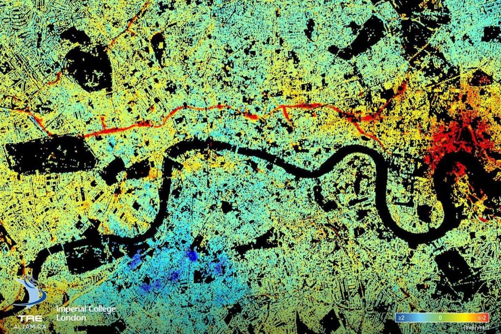
Researchers at Imperial College London created the map based on data gathered over the last five years, calculating the average annual change in surface levels throughout the capital.
And cutting straight through the centre of the image is the new Crossrail line – highlighted in red.
The rail line was completed in 2015 after 1000-tonne boring machines excavated 26 miles of tunnels through the heart of the city.
