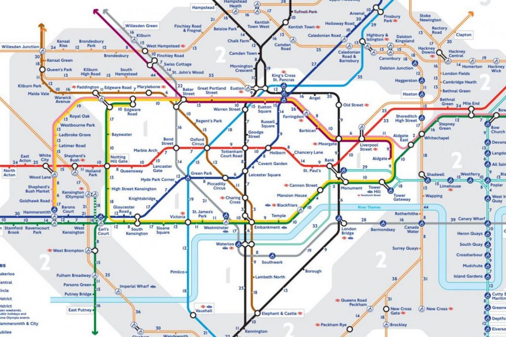
Several walking maps of London have been launched by TfL in a bid to get more people using pedestrian routes between stations.
In the maps, the number of steps and approximate time it takes to go by foot between stations in Zones 1 to 3 has been added.
Some journeys, such as the one between King’s Cross to Highbury and Islington, take upwards of half an hour on foot.
But others, including Mansion House to Cannon Street and Leicester Square to Covent Garden, can be completed by walking for less than five minutes.